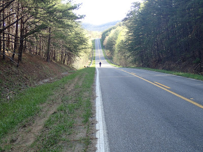
This morning was more the main event, a Sunday morning roll to inspect the doings at "The Parklands of Floyds Fork", the name belying the location of these new parks in the 'burbs where they always contrive ridiculous names that sound like a subdivision that has razed many an attractive meadow. The first of this string of four large parks- Beckley Creek- opened recently enough, so ErosPoli and I used TaylorsvilleRd. and outer J'town to link to the "Egg Meadow" ("Lawn". Whatever!) portion of Beckley Creek. I'll skip all the headwind false flats that made the first third of this ride a grind. Once at the park we found that it's all very tasteful and new so it looks great, but Mr.NegativeNed had two thoughts jump out. First is that much of the road and path (that is part of the LouisvilleLoop 100-mile loop) is going to have the same high water problems as the Riverwalk does. It runs right along Floyds Fork and it *will* be flooded at some point. It's obviously specious planning. The pic below shows how close it is to the waterline. Secondly, and it's something Poli and I discussed at length, is the total lack of connectivity. Our exit along Beckley Station Rd. provided us an opportunity to asses how one might travel from your home to the park. BSRd, instead, is a very narrow, dangerous road that no one in their right mind would travel with children. At the northern end at the exit of Miles Park you run into Shelbyville Rd. a 4-lane main state highway. You *have* to drive there, further befitting the contrived 'burb name. Recently the 'Ville scored poorly- 1 bench out of 5- in nat'l urban parks rankings, aka ParkScore. I thought this was ridiculous; our Olmstead Parks are beautiful and highly-used. The rankings, although they do include acreage, also include investment and...and...and...accessibility. The northern-most strand of the PoFF couldn't be a more obvious example of this. A third thought which I had forgotten, was my contention that the new parks would siphon off resources of the urban parks in the downtown area. It's only natural. 'Burb money will talk, and the competition for resources will pull investment away from basic services like bathrooms and potholes in current parks to maintaining flooded for wealthier surburban dwellers accustomed to getting their way. That's my pinko analysis of it, which I arrived at before taking a look at ParkScore, which agrees with me.
 |
| IF at the silos on the northern end of Miles Park. The yellow and green thing is a symbol of the new parks effort. |
| Along the concrete! path connecting Beckely and Miles, part of the long-term Loop. What will it looks like when the creek floods. Not pretty. |
After the Beckley/Miles exploration we linked through the largest suburb in JeffersonCo and later gnashed teeth with overly-eager churchists to eventually link to Anchorage where we stopped for a delightful cup (and quiche. Real men eat quiche!) at TheAnchorageCafe. ErosPoli's day was almost done with the short connect through Sawyer Park. At that point from all the headwinding I suffered earlier in the day, I took the opportunity to bomb down Westport with a solid tailwind and put together my quickest laps of the day to finish up with 42 miles of clement, sunny, 'Ville-drenched cycling. *Much* better than watching other people's children play tennis. (Don't forget SeaFoam!)
p.s. I had a LouisvilleLoop discussion a couple years back with a former classmate who works in some capacity for the city and the Loop project. My complaint at the time was that is seemed like a LONG liner park with very little thought to it being used to GET places. My 2-mile window on this new portion recently added confirms my opinion as strongly as possible. It's a toy, not transportation.


5 comments:
" It's a toy, not transportation."
Yup. That sums up my concerns with the project. It's a nice effort (though sorely lacking in some areas -- accessibility being an increasingly-obvious one) for a recreational facility; mostly useless otherwise.
My concern is that this is what we're being given as our token "Here's your bike infrastructure, now shut up and get on the sidewalk" prize. That would be a big step in the wrong direction for Loovull, and one that's going to cost it in terms of attracting progressive young workers and the firms that like to employ them.
Then again, Kentucky is doing everything in its power to scurry back into the 1930s anyway. Personally, at this point, I don't plan to stick around for that ride.
(Good write-up, btw. I still, of course, want to go see this new MUPpage.)
Since the Parklands are privately owned/run, it's not possible for them to 'siphon off' $$ from Cherokee/etc. They have met their $220,000,000 fundraising goal for initial build already and are only like 20% complete if that. Give it time, you may be surprised what it's like 5 years from now, especially once the bike park gets built and you're able to ride bike paths from Bardstown Rd all the way to Shelbyville Rd.
So, Anonymous, "TheParklands" are a private park? Was any public money involved, then, in the financing and procurement of this project? If not, then it's a pretty ostentatious land grab, but at least it's a nicely-landscaped one.
As to bike paths from B'town to S'Ville, there is not doubt that you'll be able to ride bike paths from Prospect to Farnsley-Moreman. My issue, as stated, is getting from your residence to said bike path. It's a plan that promotes car culture, even demands or requires it. It's a road- er- path to nowhere.
that is a handsome IF...
;)
that is a handsome IF...
;)
Post a Comment