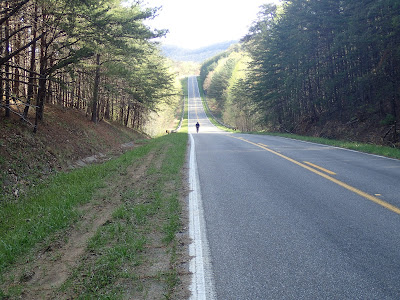
We began Day 3 with a basic breakfast at the restaurant, again better than camp cooking a salt bomb,and bundled up for a long descent in the cold (the same descent we partially covered the previous evening). Aside the cold, the bonus of the day was lots of sun and blue sky. Looks were looking good.
 |
| Aero!! |
Our 7-mile warm-up made for a pleasant early morning. The off-road Skyway began in earnest at Adams Gap. We found manicured gravel and occasional glimpses of humanity with a few nice country homes and seemingly some more lots being prepped. In some ways that ways strange because in our previous days we saw virtually no construction save the state park.
At mile 12 things got more interesting when we left the manicured gravel for some tough-and-tumble off-roading. This section of road reminded me very much of not-maintained roads in Daniel Boone NF in Kentucky. I liked it very much, although this section did open with a 1.5m climb. More climbing.
 |
| I wished I had stopped and better inspected this section. The rock here had a sparkle to it. Unfortunately I have virtually no knowledge of geology. Fun section though. |
 |
| Some mighty fine adventure bikes in this pic. I'd say each owner is quite happy with the purchase and set-up. |
A long technical (not singletrack, just chunky) downhill led us to the creek and then a short time later to our mid-ride stop at the church at Horn's Lake Rd. As previously noted on the AL Skyway route, this church has a spigot, a trash dumpster, and a nice porch for a quick rest. We took full advantage. Thank you, church at that corner whose name escapes me. From here we faced the second longest climb of our trip, up CR307/FR600-1, a 3-mile textured haul. Strangely, I got the best phone service of the trip at the start. As Pondero distanced on the climb, no shock there, I stopped to answer some texts, all while in a very sparsely area. Technology. Modernity.
And then we climbed. Strangely, midclimb I found Pondero talking to a guy in a big pickup truck. I figured Pondero had found an interested local. Instead he had run across the race organizer of the Skyway Epic, which ironically was to start on Friday night, the final day of our adventure. Where we had split the route into 4 pleasant (albeit hard) days, the mtb racers were going to do it all in one day. This year the race was introducing a 280-mile, self-supported race. Boggles the mind, really. The contrast of the race organizer enjoying the same roads as we tourers was fun. He base us adieu and we returned to our climbing.
After several miles of rollers along the ridgetop, we found a spectacular overlook into western AL. We contemplated stopping here for the night but decided it was too early. We ventured on. I really enjoyed this section of road along the ridge on the Skyway. The blue skies and mild temps helped.
 |
| Pondero looking very heroic. A man assessing the terrain. Discoverer. |
 |
| Me gusta. |
After our visit to the Horn Mt. Fire tower, we started looking for our evening spot with a bit more interest. We were still in good time, but I for one, was ready for a bit of camp r & r. I passed (Pondero being up the road) a blocked-but-passable road to the right, one that maybe would provide some open area to set up camp. Not much further, though, I saw his bike perched up aside a tree, but no sight of Pondero. Shortly thereafter he camp traipsing up from the bush after having done a bit of recon. To his mind, he had found it, a camping spot at an overlook that also would give us a bit of cover from the road. I hiked down as well to survey and gave my seal of approval. It might have been a bit too close to the Pinhoti Trail considering etiquette- we were even greeted by a passing through backpacker- but we practiced no-trace camping as best we could.
I'm not sure the pics below reflect how cool this spot was, hovering over the valley with the entirety of western Alabama on our feet. We even had some rocks on which to perch our camp stoves. It was just all good. I took many pictures, most of which did a poor job showing the campsite. It was just one of those special moments that will live longer in the memory than in pixels. "Oh, that night atop the ridge overlooking the valley, hammocking under the stars." It was grand.


1 comment:
Yes...that camp spot is memorable like that shelter from last year, but for different reasons.
Post a Comment