Wednesday, February 18, 2015

Snow Days

Although we had numerous days of precip last winter, this week has been our single biggest "snow event" for perhaps around a decade. With a couple snows we're sitting on 10" of the white stuff right now, and temps are to plummet to around -10F tonight. I've been off of school for three days, and on two of those I've apprised myself of 3.8" tires to create bike events, however satisfying or frustrating they have been. I also crawled on a snowy roof and almost fell off, but that's a different story

Monday mid-event I went out and found conditions to be taxing. I think we had more snow on the ground (having neglected to go to more than the coffee shop in the morning. Mistake) and I was having a rough time plowing fresh powder. I did a bit of golf course exploring and found it to feel like very deep sand, every revolution 3 steps up. Pant, heave, push, grunt, pant.


After a downhill which comprised of pedaling to keep forward motion, I stopped by to take a couple nice pics of Beargrass Creek and then found that my rear tire was being wonky. I had backed it down, but it felt flatter than it should. Did I really take that much air out?


Long story short, my tire was going flat and eventually went flat. I basically rode/walked home in the mid-teens temps and had a jolly, ol' swell miserable time of it all. Someone on Google+ later informed me that presta valves have a reputation for freezing up and leaking air. I suspect my fiddling might have created such an outcome.

After a miserable time Monday in a pique I didn't ride Tuesday, but instead climb on a snowy, slick roof and tried to remedy a leak behind the wall. The melting ice and snow had created an entry point. The roof itself isn't that high, but I felt stress hormones most of the afternoon after that. Miserable.

This morning I awoke to 2" more of snow. I used El Fatso to head up to the local coffee joint and graded and sipped for a good while, eventually joined by a co-worker. I'm not sure how much grading we actually got done.


This evening L had a long sax lesson- and the wife is cooking chili- so I rode from his teacher's house for a cold, windy snow loop back on the horse. The tire is holding air, so I assume the valve story is holding as well. I found a variety of conditions, with the trail snow and wishy-washy, and many of the streets a soupy, peanut-buttery kind of slickness. It was hard. The following pics are in reverse order. You'll just have to cope.
Down Beargrass Creek Trail, the longest, hardest mile of cycling I've done in a while. It took me 16 minutes when on a good day I do it in under 3. The easiest way to make progress is/was to cut fresh powder in lieu of falling into other folks' tracks.

Camera really didn't do justice to weird sun/sky/snow combo.

PJ and I rode this on Sunday and it was frozen dirty. Not now, and not any time soon.

Snow-covered creek barely visible.


Sunday, February 08, 2015

Ferdinand S24O

It's cheating a bit to call this a S24O, but we left town at 6.00pm and were back at the house at 2.00pm, well under '24' status. PJ has had many life responsibilities, but we finally scheduled a weekend camp/ride to knock off the cobwebs. I had the further motivation of giving the new Jones a thorough introduction. As read, Ferdinand SF has more of an old-school mtbike feel to it, so I knew that a little water would be much less of a problem than on the local groomed options.

If we had left on time, we would have caught the sunset at camp, or maybe even missed it through the trees. As such, we were entertained with great views for the majority of the trip up I-64.


FSF is rather remote. I expected the warm weather- 50's in February!- to bring out a few campers, but we were the only ones in the campground. I suspect we were in the exact same spot as last time, near water and the facilities. A team effort of wood from my backyard stack and PJ's fire skills had us toasty over a fire and cooking a supper of several things, pad thai noodles with chicken for me and I believe some salt bomb for him. The beef hotdogs over the fire set the scene, as did the bottle of grape juice. Refined, we are! Refined!


With my limited camera skills, or at least limited set-up, this was the best I got of the nice, yellow moon that greeted us late evening. Not only was it warm, but we had a very starry sky to admire. And warm temps! 

I've yet to solve the camp sleep thing. My pad lost air, as usual, and I tossed and turned all night. At one point I was semi-awake at 3.00am listening to the dogs and coyotes try to outnoise each other.  I finally got up to, you know, visit nature, and decided to use my silk bag in addition to the Mountain Hardware 45. I don't know what the evening temps were, but that combo got me some extra hours until 7.


 Camp coffee, yes. I used a the Soto Helix dripper again to good effect. I think PJ went with the Starsux Via standby. Not a bad choice either in times of need.


I think I did a better job setting up the Nemo last time out. I had a corner popping up for some reason and had to use stakes. The wind picked up with the evening, so by bed time I had all 4 corners staked and two ends guyed down to keep out the drafts. 

 Jones ready for a first real ride. What would await?


 This was a noisy critter up there. I think the best chance is a Downy WP, but really I have no clue. This pic doesn't have enough detail to help, at least without some CSI image cleanup.

The plan was to do some mtbike trails in the park in combination with a 20-mile gravel loop in the area to give us a nice, mixed morning. We decided to start with the trails, driving to a close-by trailhead. It's sort of hard to describe FSF trails. We found a mix, a real mix, of somewhat untechnical trails with lots of speedy downhills, lots of punishing uphills, and enough stream crossings, leaves, ruts, and "stuff" to keep things interesting. I liked Fox Hollow Trail for its interesting textures. We made an early stop to shed a layer. I pushed the Jones early on to get a feel for its capabilities.


 Something pretty common in FSF, a singletrack feeding into a wide forest road. It's seems to be half/half. The roads aren't particularly easy, as several had sizable climbs.

Perhaps I pushed the Jones too much. I decided via Jeff Jones to have the rear wheel as a tubeless setup, as all the cool kids are doing that. Problem was, as we crossed the entry road and began the second trail- SouthRidge- I noticed the rear wheel going soft. Drat! In what was one of the worst tire changes ever, I ended up mounting an extra tube, all the while burning through 2 CO2 cartridges, and using PJ's pump to top things off. My theory is a leak at the valve stem. My lack of skill was very apparent and I suspect this little "situation" cut into some of our later riding. Yes, it took that long.


One of my favorite sections was SouthRidge along the lake. The trail leveled out a bit to allow for nice views.

 A leveling out became a fierce, quick climb with some switchbacks to climb away from the lake. This was the first section where I really, really redlined. Foreshadowing.


At the end of SouthRidge the trail dumps you across this creek and into a picnic area, where we picked up Fossil Lake trail with its steep little opening. More redline. 

As some point at the crux of Fossil Lake I thought we followed signs for the Twin Lakes trail, which would take us up the eastern side of the forest. Not terribly long after that it dumped us out on the road where we started, somehow missing Twin Lakes. I'm still confused where we missed the the turn. After a couple toasty, tough sections I asked to use the gravel roll to collect myself, and we would push on to see what might happen.


At the northern end we decided to do the Kyana trail and found a couple miles of really soupy, gravelly, messy fun. It wasn't "mtbiking" per se, but it was off-roading and a ton of fun to slop through. At some point PJ stopped for a chain issue and I chugged up the climb, at the top of which we found a really nice pine grove before diving back into singletrack. Nice section.


After an exhilarating descent  we followed along bottom land, including the crossing bridge, before beginning the climb to the fire tower. Where are fire towers located? Yes, at the high point. This climb was a walk-n-ride-walk to the top, a *hard* walk. I was pretty cooked at this point, and we both had some time pressure. After the fire tower we decided to head back via a bit more gravel, giving us 2 hard hours of riding and close to 3 total.


Jones thoughts:

  • Fun
  • Handles as good as advertised. It's sharp, precise, and confident. 
  • The combo of front fat, truss fork, and Ti made for lots of front suspension without the compression of a suspension fork. It worked *really* well. And my upper body feels great even though the trails dealt out some punishment.
  • The rather far back position helped with muddy traction, but I still lost purchase sometimes.
  • My lower back is really sore. I don't know if that is a function of the geometry, a poor night's sleep on the ground, or just being fat and old.
  • Fun
  • The position is like none other. You sit very in the middle of the bike instead of being splayed out forward. Jeff said I might climb more out of the saddle and I understand why, although I didn't much b/c of wet conditions. Again, you're in the middle of the bike, firmly planting both wheels.
  • The Jones fork bag is alright but I need to work on positioning more. It held my jacket when I took that layer off. The weight wasn't a problem, but it rubbed the tire a few times. I can see using it for trips but not for day-in-day-out singletrack riding.

Jones Diamond Thanks Dad!!


I'm not sure what I can say. I have a very successful father who sometimes buys me bikes. I think his rationale is that A- he has been successful, B- I like bikes, C- I pay my own bills and do things pretty well (just named KY Girls Tennis State Coach of Year), D- He's not getting younger, so for some reason, he offered to buy me something interesting, so...

It's a Ti Jones Diamond, standard XT build, bb7s, ChrisKing rear wheel. I love the Mukluk and the ability to destroy, but I've wanted something more singletrack-worthy, something that doesn't feel like a tank. The Jones doesn't feel like a tank; in fact, the Jones feels incredible! The truss fork and fat front just rolls over stuff and the tight rear wheel tracks along. It was simply stellar during our multi-hour punishment at Ferdinand St. Forest after a campout. I mean, I just crushed the downhills.

Yes, it's a little embarrassing, my stable of crazy-ass mounts. But if someone came to you and offered, I'm not sure many would turn the offer down. I've only been on the Jones for 2hrs/10 miles of rugged, old-school mtbiking, but it was freaking awesome!

Wednesday, February 04, 2015

Sunday, February 01, 2015

More S-Tree Delight

Dave and I made another return to S-Tree, a trip that originally included an invitation to a several KY-based bicycle adventurers, but one at which the usual Dynamic Duo showed, for good or ill. Life gets in the way.  The previous trip involved a track that we cut short due to the strenuous nature of the terrain and of the unexpected hike-a-bikes, so I call that the S-Tree South route now. We set out to explore the S-Tree North route, smartly limiting the mileage and also smartly preparing for winter water crossings with Crocs and towels.  As ever, the trip did not turn out as anticipated.

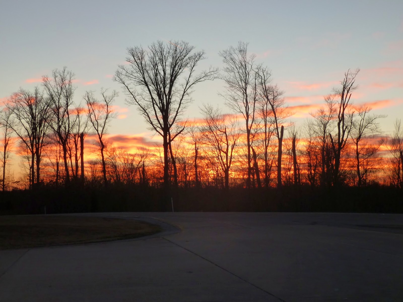
We headed down "S-Tree Lookout Tower Rd.", which is also known as as "Tussey Hill Rd." on googlemaps- Oh!- and as "Bear Gap Rd" on the KY .pdf maps. I'm sure it's got 3 or 4 more names as well. Our departure was met with chilly temps but with a nice infusion of sun to motivate us.


Shortly on we made what is our typical early mistake, overrunning a turn and having to circle back. Our descent from the ridgtop was to be on "Gibson Rd." (I'm intentionally using quotation marks as the names of these things are entirely random and circumspect), but there was no Gibson Rd., not really. We saw a roadbed populated with saplings and assorted stuff. Having a zest for tomfoolery, we decided to trudge the "road"; the track followed it, the gps showed it, and we followed along following the indentation that might have been road-like at some point. What met us was a multiple-mile plunge down the valley on a road that hadn't been passable in years and years. Every so often we had to clamber over treefall and thick rhododendron thicket and generally bushwhack along.


It wasn't too bad, but mid-way we encountered a big gully washout which I surmise is/was the justification fo the road closing. No vehicle of any sort was going to negotiate the spot, an they didn't want to spend the $ to fix out, so "Not Road" began. But what do I know?


Careful eyes here will find a posted sign of some kind of property boundry. You can feel completely lost in a wilderness, but none of this is true wilderness. There is also a beer can to be found. 

We eventually met back up with some type of trail which sees more regular use. That led us to the intersection with actual roads and continuation of the journey. 

Dave hopping the last log. 

 Maybe the Most Bizarre Award of the day, a gravesite along said trail, sort of close to roads and such, sort of not.

We were deposited into a clearing that had seen obvious use with its large fire pits and tire tracks. It seemed like quite the place to set up shop, drink some beer, and get rowdy. Fortunately, no one was around, so we got the chance to have a bite after our bushwhack and get our bearings for more "riding".


 Said party spot. Pretty.

We found the remnants of Raccoon Creek Rd. and HLCRd. and set up for our first creek crossing, using the Croc method to keep our shoes and socks dry. Worked like a charm. Dave walked across while I rode, but we were equally dampish. Our method worked well on crossing #1. It helped that we had a concrete crossing base and that the water was only ankle to mid-calf deep.


 Somebody seemed inspired to post a variety of signage for Horse Lick Creek mussels. There were 4 more in the area.


Barely discernible rope swing in this deep, green pool. A bit chilly for such activities. 

Occasional remnants of times past. The history major in me is intrigued at the passage of time in this kind of area, with historical maps showing schools, churches, and town names. Not so much now. 

Our next batch of fun involved turning onto the road/not-road of Loam Hill Rd. Google has it quite short farther north, the county map a bit longer south, MapSource as a through road. Ultimately I knew it to be something because Strava has it as a segment which several folks have ridden. Complicated, but boondocking requires research. What we found was a challenging, muddy, rocky climb which we did slowly. Towards the top we found another rhododendron copse with a rock overhang to visit. We didn't stay long at all there, but I mentioned that it would be interesting to stealth camp in such a place. It's probably illegal, though.


Facing topography, overhangs, and rock houses. 


Somewhere towards the top of the Loam Hill climb we encountered for a second time some nice gentlemen exploring the countryside in their Honda 4x4. I asked for a pull. We had previously seen them while drying off our feet from the first creek crossing, and again at a distance at a turn. I think it was they who were taking some target practice.  Loam Hill eventually became a bit more rideable, but still challenging with a mix of sand, sandstone, gravel, and mud. It was the kind of road that shoes as pretty flat and easy, but really given the surface and small rollers proved to be interesting due to small challenges along the way.


We last ran across our fellow adventurers here at Carpenter Family cemetery. We talked a bit and then one of them launched into a description of some routes we could take, none of which made much sense. The combination of thick accent, quick-paced delivery, and random road names made for a fun-but-bizarre moment. The cemetery can be barely discerned at coordinates- 37.382684, -84.125502-
deep in the middle of a batch of forest. 


I posit that these are Turkey prints. We saw several along this ride. They're big enough that they have to be from a big bird like a Turkey or Heron, but no way a Heron is wandering up along this ridge. 

 Watch the right turn.

The only remaining snow we found on a road bed. There were small splashes in the nooks and crannies of logs and such, but his patch lasted perhaps 50yds. Can you say "north facing"? 

After the sandy ridge run along Loam Hill Rd., things got even more interesting with our right turn (here the fork to the left) down Loam Hill, who knows if it's a road? Google/KY doesn't have it as one and shouldn't. It was a rocky, rutted careen down the hillside, and my favorite cycling of the day. I used the Mukluk as a downhill bike and rode sections I would usually walk. Big Grin.


Big rocky steps. I took the less nutty line to the left. 

 Dave at the top.

 No theories on these tow flannel shirts.


At the bottom we found the intersection that on some maps calls the placename of Loam. The second pic shows a stone fireplace and to the right an old wooden building of some sort. To think that at some point this was a "town" or something is just beyond me. It's deep, way deep. There were numerous 4-wheeler trails which could be explored, but we after a snack we took a left onto Bethel Rd. and made more foward progress. At some point in here, while having enormous fun, I decided that the best thing would be our usual, which was to cut things shorter from the original route. We had done significant hike-a-bike sections, and faced at least one more monster climb.  The flattish roll along the creek, while rocky, provided some easy terrain in comparison to the whack Loam downhill we had just cleared.


4-wheeler/ATV playground 

We spent a bit of time at the confluence of Horse Lick Creek and Clover Bottom Creek (USGS Topo). The water crossing was very doable here, and we analyzed the various route options to maximize our trip, deciding as best we could on following our planned track and then making for the car instead of turning north as planned. We had done S-Tree South, but yet again S-Tree North was for another trip. We took a good while at this intersection with the creek, crossing, and old cabin which we did *not* enter. What faced us above the cabin, on "Tark Hill Rd." was a half-mile dirt climb whose numbers don't look as impressive as the experience. We both had to push the lower section, during which I got my bird on with an active group of Juncos, a Downy, and an unidentified bird I wish I had had the binocs to view. It was a good distraction from the slog.

Clover Bottom Creek straight, with Horse Lick Creek to running to the right. 


Fatty at the confluence. 

 Looking up Horse Lick Creek. There were a couple of faint trails running up this valley too. The crossing of Bethel Rd. can barely be seen on the right bank. Another day.


 I'm a fan of the blue Crocs. I think they did the trick. I rode with in my original boots and got some water down my right foot. With wool and the temps I didn't get particularly cold feet. If done again I would have changed like Dave.


One of the more bizarre finds of the day. Many of the dwellings in the area are long gone, down to foundation or a random fireplace. This one is in bad shape, but not *bad* shape. How long as it been abandoned? 

The lower steep grind up Tuck Hill. 

Where's Waldo, er, DaveC? On the upper slopes of Tuck Hill.

I like the line of upper Tuck Hill. This climb, while missing from numerous maps, was a much better surface than some of the "roads" we've traveled in the area.  

Atop Tuck Hill Rd. we surprisingly ran across several signs of human habitation. The fence closed a trail that runs to the end of the ridge. Cabin, maybe? We saw 2 or 3 other livable cabins as well, one with propane tank and water features and the other at a distance with a window AC unit. Further map inspection show power lines running from the valley floor. The road surface, though, was at best "unimproved".


At the intersection of Tuck Hill and the "main road" we found a smooth gravel track and the general direction back to the car. This felt like pavement compared to much of what we encountered the rest of the day. Aside a quick foray onto the 4-wheeler/horse/bike/hike Sheltowee we rode the gravel directly back to the car.


The day closed with a changing of clothes into something dry and clean-ish and a pizza stop in Richmond at the same joint we used back in November. How you could pack so much into 18.5miles I'm not sure, but Now that we've done S-Tree South and S-Tree Mid-Central, now we have to make plans for North and Central-Central. So much to explore, and the Fatty is the best bike to do that with. Amazing day.


Alabama Sky Day 3 Vistas

We began Day 3 with a basic breakfast at the restaurant, again better than camp cooking a salt bomb,and bundled up for a long descent in th...