Saturday, June 27, 2015

Ye olden days: LHT

You know, the worm hole. Here's a pic from 2009 of LHT on a 15F New Year's Day with Dave. The LHT was in its prime. Good bike that one.


  DSCN3081


I sold the SSFrankenTrek today. It goes to a good home. The LHT has a good home too, but I still miss it.

Thursday, June 25, 2015

Whew

It's been a rough couple weeks, not the serene float I expected or hoped of for summer. Here's something fun to distract.

Saturday, June 20, 2015

My Friend

After a 5-year struggle with cancer, Drew passed at the beginning of this week. He was a former student with whom I kept up, but with whom I more greatly reconnected through cycling. He had a femur replaced due to bone cancer and couldn't really jog anymore, so he took up cycling for fitness and sanity. We had many nice rides- not enough- and he motivated me to participate twice in the Bike to Beat Cancer. He left the world too early and I will miss him and his great spirit. As Patrick said just this morning in a poetic cyclist way, "May we see him at the top of the climb." Peace friend. Life is short. Drink it up.

Matt F and Drew H to the right at the 2013 Bike to Beat Cancer. Team Om Nashi Me.

Wednesday, June 17, 2015

DBNF 2015 Livingston, a KY Trail Town

Our 4th day started early atop S-Tree, where we ate, packed, and were on bikes by 7.15. I knew we had a short-but-tough day in store and was excited to see what Horse Lick Creek Rd. looked like in summer instead at 30F. The first 7 miles were rolling, smooth gravel, and the flow along Carpenter was really refreshing. I'm not sure I want to climb Carpenter, but that few miles was as relaxed as I felt on the entire trip; my legs were tired. Carpenter had no houses until the very end where we ran across some ranchettes and what looked like an outdoor living room or schoolroom. I had to keep focused on the .gpx because, again, there was a "not road" somewhere at the end of Carpenter. We found it around the corner from the cemetery.


Now that's a new spot to put your sign, behind some boughs on a tree. 

Flow 

I didn't want to get too close, but the building to the left was set up either like a living room/movie room or maybe a school house with activities stations. I didn't want to disturb the locals. 


"For sale", dear. Hermitage. 

Again using Strava segments, I knew this trail existed. It was a half-mile rock-strewn bomb down into the creek valley. At the bottom we veered ever so slightly off the .gpx and ended up on a slightly road than anticipated, but eventually found Raccoon Creek, which Dave and I had previously ridden. We weren't lost.


A pic from the bottom of Carpenter. To the right, by the field, we found a "Private Property" sign. The road-like entity behind the puddle is a "road" I think. We veered to the left on a more "road-like" structure. 

Horse Lick Creek Rd. is a long stretch of 4x4 trail, although a horse had trodden our route recently according to fresh tracks. As did Dave and I, Patrick and I negotiated rocks, roots, mudholes, trails, gravel, creek crossings, trail offshoots, and such. It rides much more like a singletrack trail than it does a road, so some 8 miles in distance feels twice as long due to the physicality and attention you need. At one point on a severe ditch crossing Patrick's rear skewer pulled out. What was a quick fix could have been a long walk what with nothing for miles. I'm not sure if I enjoyed the summer or winter version more. The forest tunnel was very muggy, sauna-like.


 This pic below is the creek crossing that turned back Dave and me in the winter. It looks like the creek is now a couple feet lower, oh, and 60F warmer. Patrick and I used the crossing to rinse of the bikes a bit, and with this crossing we knew we were nearing the end of Horse Lick.


This is actually White Oak Rd. I had us turn here due to memory, only to find a bit up the road that the .gpx had us turning the other way. It would have been a dead end some miles into the forest. 

While strenuous, our last day from S-Tree to Livingstone wasn't going to be particularly long due to our camp move a few nights ago. Once out of the bushes we took 89 all the way to Livingston, a nice and smooth, river run  with little traffic. I was pretty blown up, though, and found the lack of coasting to be a chore. I was cooked.

Intersection of 89 and 490. Nice bridge. 

Markings at this intersection for the Sheltowee, Rockcastle Trails, and DanHenrys for the Redbud Ride.  

At this side of the bridge, Patrick, who at this point was ahead of me, had an interesting interchange with the local constabulary. He approached Patrick and asked if it was our vehicle parked in town. Patrick responded "yes" expecting a ticket or excoriation. Instead, the officer expressed relief as we had left the car overnight and the locals thought something had befallen us. Nice to know that someone cares. Small town life, you know.


 About Livingston. this small railroad town is trying to rebrand itself and drum up tourism as a "KY Trail Town". They've done a nice job with displays, trail maps, signage, and a visitor's center in the old school. A couple earlier posts had pics of signs of their trail markers, not only for bikers but for horses and drivers too, in addition to the Sheltowee passing through town. As we finished our ride we decided to eat at the local diner, which sufficed.  I hope Livingston's strategy works, as it was a nice little rural KY town and one that deserves a visit, especially from those looking to explore the beautiful countryside in the area.


Well, this is where things get a bit more, or less, interesting. The plan was to camp one more night, likely at Holly Bay campground at the location of a well-rated singletrack trail. We would unload the bikes and take a real mountain bike trail ride as a departing shot to a great week. En route we washed the filthy bikes off and grabbed some more liquids and a snack for the 30min drive down to the campsite. One there we asked for a pass to check out the primitive sites, which had communal water and restrooms. (I won't write much about the crazy speed lady) The price was fair and we strongly considered how we would spend Friday afternoon and evening before riding Saturday morning.

A few issues came to bear, though. The heat was becoming a bit oppressive. Did we really want to lie around sweating all afternoon? And sleep in it that night? The forecast looked like rain. Did we want to be hunkered down under the tents in the rain? I encouraged Patrick to take a test run, to ride a portion of the trail to see how we liked it as a motivating factor to stay or not to stay. We were decided. Run some trail and see if it was worth it.  We parked outside of the campsite on the north end of the trail  and rode a very short section to find steep rollers, ones which burned our tired legs. Ugh again.

We crossed the road and tried a different section of trail, one we were supposed to do out of Bee Rock but bailed on due to rain. It involved a 2.5m downhill to some falls and then the climb out.  As the pics may attest, this section of trail was very challenging- "old school mtbiking" as I called it- with few "flow" features or manicuring. My pictures are mostly of the more rideable areas, but we both had to dismount plenty. I suspect it wouldn't have been that much fun fully loaded; it wasn't that much fun unloaded. I think at the end of the our 5 miles-ish of singletrack that we had satisfied our riding jones for the week. We loaded up and headed back to the barn, satisfied that we had done things as well as possible.


Tuesday, June 16, 2015

DBNF 2015 Atop the infamous S-Tree

Two days down, two to go in our DBNF 2015 tour. We had completed our southern loop, combining some new-style bikepacking with traditional tent camp just outside of Livingston on night two. With the change in venue so did change our route for day 3, but not by much. We began the day fording the Rockcastle, which put on onto Wildcat Mountain Rd. An interesting note about the ford is that there is also a railroad bridge crossing that can be used. Both options initially scared me, but I used the magic of social media and Strava to contact a KY-based rider who has segments all over the C.KY area. He commented that the river was cross-able and the bridge not a terrible option. He was right and modern technology wins again!

Rockcastle River by morning

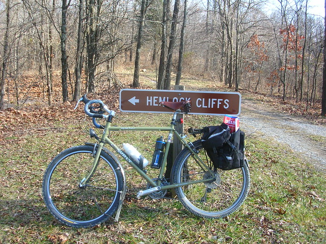
Trail marker before crossing the Rockcastle. More on that later.

Nice legs

Rockcastle Rides. More on that later.

The railroad bridge option. Note the little walkway to the right. This looks doable. And an older woman in town later told us that it was crossable as long as you hurried.

The ford over to Wildcat Mountain Rd. gave the morning a little bit of pizzazz, and the climb up the mountain itself gave a hearty wake-up call, although the grades were never so steep or miserable as to ruin our early morning mood for adventure. At the top we were greeted with a variety of exhibits about the Battle of Wildcat Mountain, a Civil War battle taking place early in the skirmish. We took a bit of time to read up on the local history and to use their much appreciated facilities. Afterwards our route rolled on via Wildcat Trail, which depending on the the source was a real road, a trail, something else, or nothing at all. The only sure thing was that it was part of the Sheltowee, so something existed.


Gentle slopes up Wildcat Mountain. 


Gazebo and exhibit at the battle memorial. 

Interpretive trail atop the mountain. 

What we found in the first section of Wildcat Trail was some near perfect mixed-terrain riding, with its mixture of sandstone, gravel, sand, mud holes, contours and such. It was evident that the road rode the ridgetop, and especially to our right (north), we occasionally were treated with big vistas across the forested hills. This lasted maybe a couple miles. The next mile or so changed complexion. There was a large, obvious construction project to the left, and from then on the road widened and was furrowed with heavy truck tires; my guess is logging with gusto. What was a perfect road was turned into a kind of scar.


Not long after the cemetery the road turned to pavement and then opened up to a mixture of small farms and occasional homes, although the land was still pretty sparsely populated. At some point the Sasquatch, oops, Patrick asked a couple porch sitters for some water and we entered into a fun conversation about their preferences to get to S-Tree. I recognized a few roads, but the locals never realize that out-of-towners have no clue what they're talking about, and that's fine. They, like so many of the folks we encountered, were very nice and generous, and I'm thankful for the kind treatment we received.

Winding Blade Chapel 

Feel free to chime in on this set-up. Is that a hanging table in the pavilion next to the church? It is for sacrifices (joking)? I've never seen anything like it. 


The next 20 miles of riding involved lots and lots of rural paved roads with pleasant vistas and increasing heat. The 20 miles were split sort of equally in two, descending every so for miles, bombing down to the South Fork Rockcastle River, and then grinding up the other half. I feel a bit better after seeing the profile because that 7-mile climb took its toll. I walked some, had to rest under some shade, had to grab more sketchy water from a church parking lot and generally fell behind Patrick on a regular basis. At the end of our road section I saw a nice little church with a shaded porch and informed Pat that I was resting. And we did, and did very well.

Vista 

Jones at Eberle Rd. and South Fork Rockcastle

Mas vista 

Rest stop under the shade. 

At several distinct times during our week we came across singage for the Redbud Ride, which takes place in April and leaves out of London. It must be a stunning ride given the roads we sampled. Bike goal right in the middle of tennis season. Tough one.


After our porch stop we faced some unknowns, you know, "no roads". Laurel Creek Rd. (and I believe Forest Rd 454) is definitely a road on many maps. In the middle of the forest, though, mysteries abound. Some had trails or roads, others nothing, and so we went. Laurel Creek Rd was a nice, gravelled, sometimes two-tracked gentle descent, which I needed after the rough last hour or so. We came to a gravel clearing and saw that the "road" continued, albeit in rocky, distorted form. We went for it and found some of our most technical terrain of the week. Rocks, rocks, ruts, rocks, ruts, and more washouts. Right at the bottom I got skered and took my only tumble of the trip. Fortunately the other damage was a shifted gps which took 1sec to shift back.

Laurel Creek Rd. doubletrack. Nice and downhill.

The end of Laurel Creek Rd., just behind Patrick. The mud bogs opened the chute downwards. 


I feel probably 15ft above the exit here.

Even stranger, at the bottom we found a lovely lake, as usual, in the middle of nowhere. The "road" turned grassy for a moment and then dirt along the bottom land by a creek. Our "no road" had been quite the success. And who trusts boring ol' maps anyway?


Day 3's heat and climbing was proving arduous. Our turn onto (or into) Mill Creek WMA hurled a nasty grinder of 1-mile with no shade to speak of. For some dumb reason I tried to clear the entire thing and instead put myself into the suffer cafe. The top of Mill Creek was actually quite pleasant and maybe deserving of a return visit, but that sunny, baked climb. Ugh.  Afterwards we passed through the "Federal Gov't town" portion of McKee, KY, with the many clinics, public housing units, jails, and pharmacies. The local IGA did not make sandwiches but had some of the best AC every. I had a hard time leaving. McKee became a multi-hour stop to avoid the heat. I was *insistent* that I wanted a cold sandwich- no fried things- for lunch, so we posted up at the local Subway and later under the local park shelter for another mid-day siesta.

Mill Creek sun, and more sun. 


Our last leg had us more or less coasting down 89 toward S-Tree Recreational Area, this being the first time for an overnight camp.  Disturbingly we found a "road closed" sign at the road but rode up to investigate the real status. Patrick was suggesting all kinds of crazy plans that would add miles upon miles, and I was pretty close to just giving in leg in town back to Livingston. At the road washout  I explored a short bit to find that motorcycles had opened something passable through the landslide. We cleared the impediment and then slowly and steadily clear the S-Tree climb up to the campground, which was virtually if not entirely empty.


Patrick rolling along 89 in the shade. I'm only ahead because he let me. 


Wash-out in question

Never so thankful for a discarded oil container, which gave me trail crumbs to negotiate the cut-through. 


We had the run of choices and set up camp just about at the top of everything across from the privy. With no running water, part of our McKee stop was to water up so we would have enough for the evening and next morning. We set up tarps again and both of us had to resort to bug-netting techniques, PJ with a real bug net he hung under his tarp, and I wearing a bug headnet for much of the evening. A highlight of the evening and trip was watching the dance of the fireflies from under our tarps. Enchanting.

I named this dude Cletus. 


S-Trees

Alabama Sky Day 3 Vistas

We began Day 3 with a basic breakfast at the restaurant, again better than camp cooking a salt bomb,and bundled up for a long descent in th...