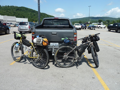
I don't know that we did enough each day to really differentiate. We based ourselves at the nice-maintained campground and took trail day rides to inspect some of the different portions than comprise the IMBA Epic. After our first day experience, we realized that we would fall short of "epic" in 2016. Below are some pics with the strava routes of each day. Outside of riding we mostly sat around and acted like we were 12 again, including the intake of fast food in nearby Oneida. It wasn't a bikepacking tour, but it did involve bikes, bears, copperheads, and really pretty scenery.
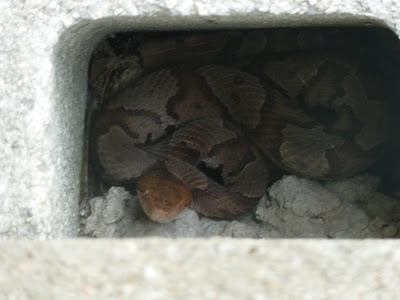
His head, in fact, is the color of copper, resting just outside the Blue Heron campground bathhouse.
As we were at BHC, the "snake man" came and took him away. Only about 2 feet. To this city slicker, it looked like certain death.
Scene at our second location, Bandy Creek campground, also part of BSF.
Part of the Collier Ridge trail at Bandy Creek. The first half is old forest road, pretty sedate. At the west end the trail dives into a couple miles of very nice singletrack.
Collier Ridge at the crossroads. I think most folks turn left and take the West Bandy Creek Trail. We didn't know much and took a right, for the CR return. It was even more sedate narrowed forest road rolling until a quick, fun, open downhill to finish the "lollipop".
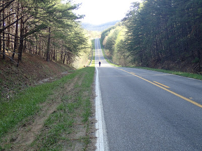
Scene returning from Collier Ridge. Pretty, but also pretty damn hot at that moment.
After our brief ride Thursday we got in the car to head to town and then for a little sightseeing on the way back. Fact is, we had time to kill. We stopped by the lovely East Rim Overlook and then down to the river at Leatherwood Ford, where the old bridge wasn't looking too hot.
We descended down to the start of the Gap Loop in the car the previous evening. It looked intense. Later study revealed favorable reviews of doable singletrack. Several mentioned the trail changing at the cemetery, and indeed there is a random grave deep in the woods along Gap Loop. I'm ever amazed the remnants of the early European settlers in the area.
This lookout is the big draw for the Gap Loop. I'm utterly chicken of hights, so I'm sure my face is in pain, but the view of this valley here is outstanding.
Typical forested singletrack along the Gap Loop, which did a nice job mixing up cliffside views with non-technical trails farther inland.
Nighttime hammock setup with lots of glow cord. Too bad the glowcord doesn't help when trying to escape from the hammock in the middle of the night. I still think I like the night's sleep better in the hammock than on the ground- no sore shoulders or hips- but it's not an elegant exit, especially with the bug net.
Friday night we went up to the field near the campground, one which had a wide expanse of viewing for star-watching. The moon was a little too bright for really dark conditions, but it was really pleasant anyway. I used my cheap point-and-shoot for these, so no blue ribbons for night photography, but it was a nice space anyway.
Although fuzzy, we have a 3/4 moon, Saturn immediately below, Antares (Scorpius) below that, and a brilliant Mars to the right. Jupiter was much further to the west too. Awe.
One-minute exposure straight overhead. Little dots of distant light.
Exposure fun with moon.

However questionable the sleep, we awoke to a magical moment in the morning. I have perhaps 10 different pictures, all with the same glorious expression of life.
Our last ride included the John Muir trail, which I see as an extension of the Gap Loop. Both are moderate singletrack trails with not much technical terrain but with plenty of flow, and of course some amazing views to boot.
With a reasonable amount of skill this set of stairs is the only required dismount on the backcountry trails at Bandy Creek.
Story needed: So I come around a turn to see this pile of scat in the middle of the trail. It looked reasonably fresh, thought I am no scatologist and took no time to analyze it. I surmised, though, that a bear had indeed shit in the woods. We had spoken to a camp worker just previously that she and/or her boyfriend had recently seen 5 black bears in the area. I was pretty cavalier until I saw this evidence that a big, furry apex predator was along our trail. I made some noise and proceeded a little more gingerly.
Ten minutes later again around a turn I heard a rustling in the woods to the right. Looking down a valley at maybe 50 yds I saw him/her, a big, black, furball in the woods, a damn live bear!! I started hollering but also tried to grab my camera. As I hollered some more he/she took a look and went high speed up the hill and out of site. Again Patrick and high made some noise and took our time, since the bear's departure cut across our future trail course. We never saw it again, which is good. But I wished I had caught the fur ball on film first.
The John Muir Trail ends up on a gravel climb working its way back towards the campground. I snapped this only because the rest of the route is heavily forested and it was strange to have a sudden clearing.
Bandy Creek is worth a weekend return, to sample the trails, and others again, while staying in a nicely maintained campground. It wasn't what was expected, but we did ride our bikes, and we did not get bitten by copperheads or attacked by bears. We had further plans for a Saturday night camp, but the weather was becoming oppressive and our time was done. Tour 2016 is in the record books.


