Saturday, April 14, 2018

Alabama Sky Day 3 Vistas

We began Day 3 with a basic breakfast at the restaurant, again better than camp cooking a salt bomb,and bundled up for a long descent in the cold (the same descent we partially covered the previous evening). Aside the cold, the bonus of the day was lots of sun and blue sky. Looks were looking good.


Aero!!


I LOVE this sign. If I had a better angle I would make it a profile pic. Pavement to Gravel. Great stuff. This is at the well-known Adams Gap, which denotes the gravel but also is a popular hiking trailhead. Or so I read.

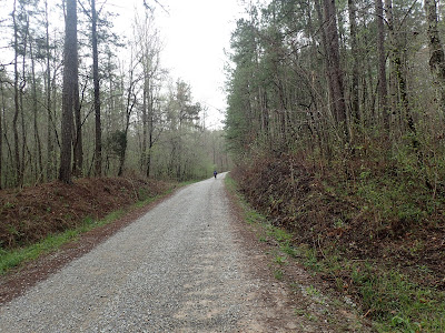
Our 7-mile warm-up made for a pleasant early morning. The off-road Skyway began in earnest at Adams Gap. We found manicured gravel and occasional glimpses of humanity with a few nice country homes and seemingly some more lots being prepped. In some ways that ways strange because in our previous days we saw virtually no construction save the state park.


At mile 12 things got more interesting when we left the manicured gravel for some tough-and-tumble off-roading. This section of road reminded me very much of not-maintained roads in Daniel Boone NF in Kentucky. I liked it very much, although this section did open with a 1.5m climb. More climbing.


I wished I had stopped and better inspected this section. The rock here had a sparkle to it. Unfortunately I have virtually no knowledge of geology. Fun section though.


Some mighty fine adventure bikes in this pic. I'd say each owner is quite happy with the purchase and set-up.

A long technical (not singletrack, just chunky) downhill led us to the creek and then a short time later to our mid-ride stop at the church at Horn's Lake Rd. As previously noted on the AL Skyway route, this church has a spigot, a trash dumpster, and a nice porch for a quick rest. We took full advantage. Thank you, church at that corner whose name escapes me. From here we faced the second longest climb of our trip, up CR307/FR600-1, a 3-mile textured haul. Strangely, I got the best phone service of the trip at the start. As Pondero distanced on the climb, no shock there, I stopped to answer some texts, all while in a very sparsely area. Technology. Modernity.

And then we climbed. Strangely, midclimb I found Pondero talking to a guy in a big pickup truck. I figured Pondero had found an interested local. Instead he had run across the race organizer of the Skyway Epic, which ironically was to start on Friday night, the final day of our adventure. Where we had split the route into 4 pleasant (albeit hard) days, the mtb racers were going to do it all in one day. This year the race was introducing a 280-mile, self-supported race. Boggles the mind, really. The contrast of the race organizer enjoying the same roads as we tourers was fun. He base us adieu and we returned to our climbing.


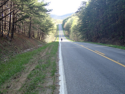
After several miles of rollers along the ridgetop, we found a spectacular overlook into western AL. We contemplated stopping here for the night but decided it was too early. We ventured on. I really enjoyed this section of road along the ridge on the Skyway. The blue skies and mild temps helped.

Pondero looking very heroic. A man assessing the terrain. Discoverer.

Me gusta.

A slightly weird scene at the Horn Mt. firetower. This spot, yes, had a firetower, but also had remnants of a former rest area of some type. It had concrete picnic tables, shelters, and even remnants of a water fountain, all very tired. Strange.


After our visit to the Horn Mt. Fire tower, we started looking for our evening spot with a bit more interest. We were still in good time, but I for one, was ready for a bit of camp r & r. I passed (Pondero being up the road) a blocked-but-passable road to the right, one that maybe would provide some open area to set up camp. Not much further, though, I saw his bike perched up aside a tree, but no sight of Pondero. Shortly thereafter he camp traipsing up from the bush after having done a bit of recon. To his mind, he had found it, a camping spot at an overlook that also would give us a bit of cover from the road. I hiked down as well to survey and gave my seal of approval. It might have been a bit too close to the Pinhoti Trail considering etiquette- we were even greeted by a passing through backpacker- but we practiced no-trace camping as best we could.

I'm not sure the pics below reflect how cool this spot was, hovering over the valley with the entirety of western Alabama on our feet. We even had some rocks on which to perch our camp stoves. It was just all good. I took many pictures, most of which did a poor job showing the campsite. It was just one of those special moments that will live longer in the memory than in pixels. "Oh, that night atop the ridge overlooking the valley, hammocking under the stars." It was grand.


Tuesday, April 10, 2018

Alabama Skyway Day 2 The Climbing

Day 2 opened damp-ish, but no precipitation was falling as we left camp. We expected a 30-mile day with a finish at or around the Cheaha State Park.  Without surprise, our day began with a climb.

Uphill, with Pondero already extending.

I wanted to get a pick of the Pinhoti Trail symbol, which is the white one 3rd down. It's was a precursor to the construction of the AT, and I've heard well-marked in AL.
Oh, look! Another climb!!


The only reason I had the time to set up for a Pondero pic was that he waited for me at the top of a climb and I descend faster than he does due to intertia x mass or whatev the physics is. He looks pretty plumb here. Good for him.

I strangely like the juxtaposition of the fire tower, tree, and modern communications tower, so a strange melange of tech and nature. This is at the top of a fiercely long gravel climb. I didn't see Pondero for minutes and minutes.


We had a jolly time rolling along our 15 miles- no, I just checked and it was only 7.5 miles, Geez!- before we stopped off at the ranger station for a water-topping and rest. Thereafter we hit pavement along AL 281 for the remainder of our day, the Alabama Skyway. Of course the AS began with a mile-long climb. Climbing. Day 2. Yes. 281 presented us with about 10 miles of reasonable rollers before the climbing began anew, in this case up to a nice lookout at mile 17. The lookout vista was the first of what have named "The 3 Sisters",  or what could be the "3 Lizards" or "3 Hills". Suffice to say the first had a nice lookout, the second I don't really remember.


It was the 3rd "Sister" that proved my personal downfall. Pretty quickly I dismounted for what ended up being a challenging walk up % grades in the teens. While not as long as the previous two "sisters", #3 was a real pain. We found some lumpy stuff at the top before a bombing descent and the sign for the entrance to Cheaha SP. And its climb.


While the star of the show, the climb up to Cheaha wasn't that bad. Yes, 3 to 4 miles of climbing isn't fun, but it was paved and reasonable in gradient. You just chugged in a low gear. Yes, I did experience a little cramping in my left inner thigh; yes, that was new. But I chugged up to meet Pondero at the top. All was good.

At the top we studied plans and decided on reserving our campsite, setting up camp, and returning to the restaurant for a warm dinner instead of camp food. The young lady at the counter suggested that the camp was about "one mile down". I became alarmed, but somehow Pondero soothed my concerns. We would descend, set up camp, and return unburdened, and easy jaunt. So we descended. And descended. And descended. We made the necessary turn and descended. At some point stopped, no campground in sight and decided that this "one mile away" campground was WAY too deep in the boonies so we decided to ascend to the hotel/restaurant area to reassess. Pondero climbed ahead while I eventually stopped to eat some welcomes PB crackers. About a mile back up our climb, (which we measured at 2.2 miles and 700+ft of climbing), my right leg began to cramp, and thusly I enjoyed an additional mile of walking uphill.


Contrast, peoples, Contrast.

After a nice cleaning (in the hotel shower. We got a room. The extremely right decision with impending mid-30s temps), we partook of the restaurant and its large burgers. Later we enjoyed the Cheaha sunset, a trip highlight. What a day! 30 measly miles and 5K of climbing. I was at my limit and eventually met my limit on the restaurant return. It was all a bit much, but turned out to be beautiful day. Hard, but I already remember it fondly.

Pondero pondering.


Sunday, April 08, 2018

Alabama Skyway 2018 Day 1

Borrowing a bit of inspiration from the Bikepacking Alabama Skway, Pondero and I plotted our 2018 Spring Break adventure around some family time and free time respectively. I'm going to regale you of our adventure although nobody really reads blogs anymore. Pondero used Instagram rather actively, but my phone had neither the battery nor the coverage to do the same, so you're going to get a rather 2010 analog version here on der blog.

We met in Birmingham, and his gracious family volunteered to provide shuttle. Very kind (and they are shown in the photo below). What was not kind was our route beginning almost from the first mile with a climb in excess of one mile up Duggar Mountain. I don't like roads with the name "mountain" in them. I went slowly, but didn't get "last" on the Strava segment, so I guess I kept a reasonable spin. It was terrible.


Notice that we're on flat terrain, but that extremely large hills are in the background. Ugh. 

Very steep profile in the distance. I walked.


After our inital climb, we were met with a few more challenges, all of which Pondero passed with flying colors while I grunted up, sometimes on two walking legs instead of on two wheels. My lack of winter conditioning made things quite evident, which is why Pondero is ahead of me in every picture. The gradient up to CR55 at "Grantley" proved particularly miserable. Once we topped the CR500 climb, we were met with a nice spin of rollers, but at least with the opportunity to ride our bikes instead of doing leg presses and adding to our step count. Alabama is hilly.


On top of the ridge, we were met with wafts of smoke, eventually rolling through a section of forest recently destroyed by a tornado. We later learned that the smoke was from controlled burns, but the combination lent an eerie World War I vibe to things.

We started our first day rather late, around 1pm. The two substantial climbs and rollers gave us a pleasant-albeit-challenging to the Alabama Skyway. At the bottom of a gravel descent we found Pine Glen Campground, which was mostly empty, giving us the pick of the litter, all for the fair price of $3. Yes, $3. A little dismaying was learning the the water spigots were all turned off, but the only other person in camp walked over and offered us a gallon of bottled water, which we accepted with gratitude. It made for an easier night in camp, and an extra cup or two of coffee.


Our focus turned to effectively tarping our tents for impending storms. The night began with a starry night overhead- and a passing bright satellite- but later we were buffeted with stiff winds and a lightening show. Pondero and I both mentioned strange dreams, but we also both stayed dry and slept adequately. We survived, and the morning was basically dry.

My Jones mount with Eno tent and Kammock set-up in the background. I stayed dry. That's all that matters.

Pondero's Bantam, but with gear still stored. I didn't take pics of his Hennessy and new, larger tent. He stayed dry too.

Alabama Sky Day 3 Vistas

We began Day 3 with a basic breakfast at the restaurant, again better than camp cooking a salt bomb,and bundled up for a long descent in th...