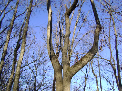
With a forecast for mid-50s and a free afternoon in the holiday calendar, I hatched the plan for a family hike, one which the wife heartily supported, 'Z' begrudgingly acquiesced to, and 'L' wanted no part of. With arrangements made for 'L' to visit a friend we embarked on the 45-minute drive to Otter Creek for a sunny afternoon of trails and nature.
Arriving there, we found that the front entry sign had been taken down and that many of the directional signs in the park were also gone. For those who don't know, the city of Louisville owns Otter Creek even though it's almost 40 miles south of the city. Apparently it was gifted to the 'Ville after the wars with the one stipulation that no hunting be allowed. Since then the city has run it at a loss even though it gets 500,000 visitors a year. In my youth I attended church camp at the YMCA camp Piomingo. With the budget crunch, the city has decided to close Otter Creek, not temporarily but permanently. We're all asking. How do you permanently close 2,600 acre park? For years the city has been trying to get the State to take it over, but that's been a no go. The recent website Save Otter Creek is certainly the best source for the latest news, but it's just a crying shame. Having had experience with Michigan's state parks, I say create a daily user fee with the option of a yearly sticker and that'll do the trick or most of it. The most recent news, though, seems quite dire. Although we haven't hiked there lately, as a family we've attended 3 different school camping outings there at the w lodges and we had our summer college reunion there a few years ago. The park offers camping, an observatory, trails for hiking, biking and horses, fishing in Otter Creek, and some of the best views in the state overlooking the Ohio. I'm just ill, but we had a great afternoon taking in parts of the Otter Creek Trail, the Red Cedar Trail (open to horses) and the VCT, but I don't remember what that stood for.
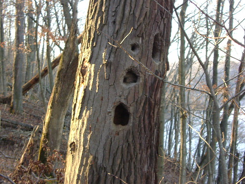 Home to someone I'm sure.
 Flat portion of the Red Cedar Trail
 Horses on the RCT
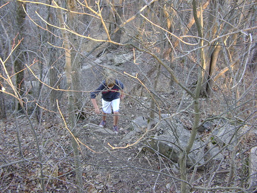 'Z' clambering back up at North Point, which is a connector from the OCT at the top of the cliff and the RCT extension at the bottom. Neither the wife nor I clambered.
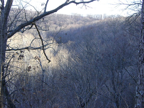
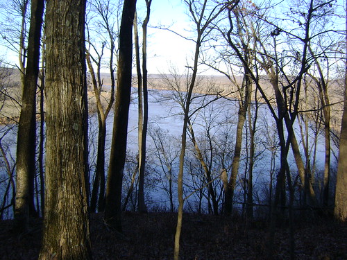
Sun and Shadow and Sycamore overlooking the Otter Creek Valley (that's right. VCT is Valley Creek Trail)
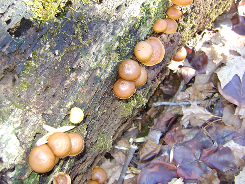
Funghi
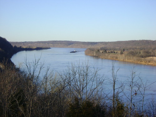
Ohio River Bend looking south. That barge, laden with coal, was moving very slowly. Apparently in its early days the Ohio varied greatly in depth. This bend was a common crossing due to occassional shallowness.
Forks. Trident.
 River bend looking north
Bucolic farm in IN across from the park. From any direction this looks like a place to live, except for floods of course.

3 comments:
I had not heard that about Otter Creek. That really is too bad. I spent some time there as a kid. We did a weekend Science camp there when I was in 5th grade and 6th grade. I had also had my first camping adventure there when my Best Friend's dad took a bunch of us neighborhood munchkins a couple of times.
In addition to all the things you mentioned, there are also excellent caving opportunities there (Morgan's Cave, Clancy's Cave, and some other ones I don't remember the names of). We also went rappelling from Lover's Leap once. And as I wrote to your wife on FB, our family went there a lot. I hope they can reopen the place when the economy is doing a little better...
--Laura
Very sad indeed. Indiana state parks charged an entry fee, and offered an annual pass, which I gladly purchased each year because I used it so much and wanted to help pay for the fantastic parks. You'd think some of these city parks would catch on to the idea.
The park needs money? How about they let us pay, then, and keep the park open!
Post a Comment