After Blunk Knob, our route crossed IN11 and ventured into new territory for me (and for him). This area is populated by small ranchettes, with the western-most portions having the typical Midwestern wheat, corn and livestock. We made a steady pace through this area, slowing for the up roller and zooming down the down roller. Of particular note, for me at least, were St. Johns Church Rd and Black Creek Rd. I enjoyed this portion immensely, with Black Creek a particular highlight. While I had no great desire to climb, the exit our of the Black Creek valley provided forest on both sides, with perhaps one house in a mile or two stretch. It was fabulous and I'll return just for that. After missing our turn at Morgans Ln- no, not for being lost but for the turn being located at the bottom of a 39mph hill- we backtracked the short distance and hit upon what was a rough patch for both of us. Dave only brought 1 bottle, I 2, but neither of us had any food. Thus thirst and hunger ensued. Morgan Ln also presented a tough test of rollers climbing out of a creek valley. Dave asked a woman walking if a store was around and the answer was 3-4m further south and out of our way, so we ventured on. Once crossing IN11 again I felt a bit like the horse returning to the barn. After a scorcher of a descent on Doolittle Hill when we almost caught a couple cars filled with teenagers, we crossed behind the casino and onto a road at the foot of the Knob "wall" on Stuckey Rd., passing some interesting houses, old barns and a further collection of farm animals, for the day: horse, cow, mule, chicken, wild turkey, deer.
Our final portion was a bit anti-climactic b/c we traversed the same Budd Rd., passing the ominous Farnsley Knob and later Blunk Knob again, only this time I was counting down the 2 warm-up climbs. I was hungry, thirsty and leg tired. None-the-less, I made steady progress up the last 2 and finished reasonably in tact. Dave and I discussed in the course of the ride that my Bleriot is geared lower than his 'Nermal' hybrid, something you wouldn't think would be the case. I used the smallest chainring only on 3-4 climbs and stayed in the middle for most. Even with grey, cloudy skies and some occasional sprinkles, I give today's outing 4 stars for the challenging route, bucolic scenery, new roads and good company.
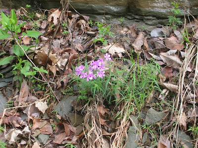
phlox at the top of a warm-up hill

gotta love those signs at the base of a climb

lovely farm house at top of Blunk Knob

beat up barn at top of Blunk Knob

Dave on St. Johns Church Rd., classic midwestern road. As can be seen, my shutter was sticking unbeknownst to me. I kept it anyway.

Black Creek bridge

Climb out of Black Creek. I tried 4-5 different shots over my head and behind my shoulder trying to get a pic of the road and Dave. You can get a bit of a feel for the trees and privacy.

'Nermal' resting on 2nd beat up barn. The Bleriot pic here didn't come out well.

pollos

2 comments:
Looks like an excellent outing. I've had some nice rides lately, but all solo. Hope you enjoyed the company.
Great ride! I enjoyed looking at the map. Some of those knobs look quite steep.
Gmaps Pedometer is not a google product, it is an application BASED on Google Maps. "A mash-up." Not sure what was going on, but when I clicked link the map loaded fine.
Post a Comment