Trailhead marker

Typical scene on much of the trial, with heavy gravel along a forest tunnel
I did particularly enjoy the first part of the trail. The pic below shows a strangely deforested, sun-searing land, and for reason, it had been re-gravelled or dragged recently, so it provided heavy, slow-going conditions. I later found on the return leg that the inital portion was a long, steady climb. At one point, the NPS even posted a sign of "steep trail" conditions and encouraged the public to walk this one off. I just rode in a tidy, low gear.
Eventually I broke away from the deforestation and back into the forest, sometimes very close to the main road and sometimes curving a bit further inward. My informative ride would educate me to 2 new nuggets, first that the deforestation was the beginnings of "prairie renewal", and secondly the trail often followed the road, because the road, in fact was laid on the original rail line. Nice and tidy, eh? I came to Sloan's Crossing, which is a sinkhole that never drained, hence a pond. NPS built a nice wooded raised path around the pond, providing multiple viewing spots.
 By this point I was having that much fun. The trail surface regularly used very heavy limestone gravel; it reminded me of riding in sand. And the heat of the day- 92F and humid, was taking its toll. After Sloans' Crossing, I roused 3 wild turkeys having a snack in a meadow, but they ran off before I could get a pic. I then descended into a steep valley, one I didn't relish climbing back out of. The trail used three wooden trestles or bridges to cross steep gorges. Soon thereafter I was almost run over by a deer bounding across the trail. Boy, they look sort of big up close. Not long after I arrived at the terminus, the visitors center and hotel. I had decided at some point that I didn't enjoy the trail surface enough to return via it, so I aimed to go back on the main road. After perusing a park map, I found a different and interesting alternative for a return. Not far from the visitors' center, the map showed a one-way gravel road- Joppa Ridge Rd.- that connected to State 70, which would put me back at Sloans Crossing and a relatively return via the main road. The descent towards Joppa Ridge had the LHT at 41.5mph on the descent. Weee!
Entrance to Joppa Ridge Rd., with barely discernible gate
If the rail-to-trail failed to meet expectations, Joppa Ridge Rd. exceeded them in every way. While only 2 miles, it steeply climbed out of the Green River valley on a nicely gravelled surface completely devoid of anything save the shade, whisper of the trees and my heavy rhythmic breathing from the climb. At some point a SUV with a canoe attached passed me, not far from the top of the climb, and I was able to keep site of him on the descent. Thinking that it was a simple "climb up, fly down", I was confronted with a short, steep climb towards the end of the road (seen in pic below). The entirely of the road was gravel, but NPS had paved- only once, and a while ago given the deterioration- the steep pitch to the top. I admit to walking a brief portion here.

Steep portion


If you look carefully, you may be able to discenrn three turkeys in this meadow. They're there. It's the same coven I passed earlier in the day. They're there, I promise.
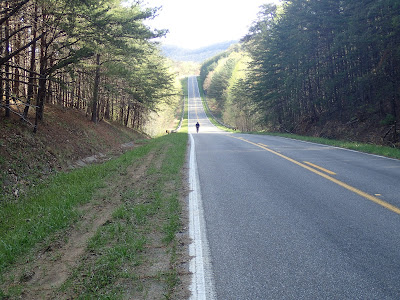
I finished the ride up on the main road towards the truck, noticing that I had come across hillier terrain than I had realized. I really enjoyed the return portion, the trail, well, I did it. It might be fun in a group, or it might be more fun when the surface improves. Nagging aside, it made for a great ride, all in all, to experience new roads, new trails, a Nat'l park, and some honest mixed terrain. yea for me!
I


No comments:
Post a Comment