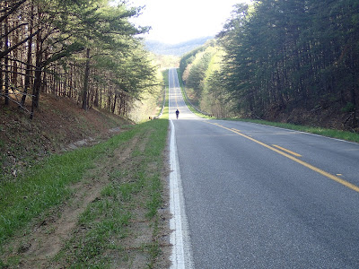
We loaded up to head home. First, though, we decided to do a bit of adventure driving (the SUV being a 4-wheel drive vehicle, right?), following the intended course down Racoon Creek Rd. into Dango and out Lone Oak/Horse Lick Rd. The pics that follow only begin to express how gorgeous and how tough the "roads" were. We confirmed with each other time and time again that there was no way we could have done this route as the 4th day of the tour. We needed bigger tires and maybe even suspension, much more fitness, and certainly the knowledge of what faced us. It was as similarly intimidating as the BigSouthFork route from '10, only I think the surface was more challenging, boulder-strewn, and impenetrable. FYI, our drive from the bottom creek to the paved 1955 had us at 11.5mph avg...in the car. On a loaded bike?
We will be back, though. Beautiful!
 |
| Honestly I don't know how they live there. There is nothing in the surrounding 10 miles, and the roads are a suggestion of transportation. |
 |
| Similar to many creek crossings with effective concrete surfaces. |
Somewhere at the bottom in Dango (no dwellings, just a name), we ran across 5 or 6 atv riders. I conferred with the "leader" who verified the way for us to get out. Impressively, my car gps and the hand-held Garmin had the necessary goat paths, both better than the county map which seems to have given up.
We exited onto 1955 and set the gps for home, still taking in a few paved roads that would've been on our Day 4 route. I don't know what to say other than I wouldn't have been able to pull it off, I think. Amazing terrain, though. Powerful. I sit here a few days later sorry that we "gave up", sorry that we had mechanicals, sorry that I didn't have the necessary fitness, and hoping for a return sooner than later.
 |
| Panorama from the car at 1955 and 1004, one of the best vistas I've seen in KY although a bit out of focus here. Sorry Michael. |


4 comments:
I enjoyed the entire report, and was pleased to hear that the trip apparently left you hungry for more.
I guess the Troll did his job, eh?
@Pondero, more Troll discussion to come, but not positive. I'm going to make appropriate contacts first.
More excellent scenery ... and so gnarly. It would have been such a sufferfest on the bike. Glad you still got to see the area though and get a taste for what's there, and a better idea of what's needed to actually be able to explore it.
You boys were all up in it. Those are some great roads you were on. And there are more like it. The scenery around here is fantastic and sometimes I take it for granted. Always nice to see it through someone else's eyes.
Every time I go to Louisville I think about moving back there. Then I come home to Berea and am reminded why I stuck around to begin with.
Post a Comment