Wednesday, June 29, 2011

SCS June (+fotos)

My final mileage total for June was/is 627. I'm cutting it off today b/c I taking some teenagers to Kings Island tomorrow and I do not intend on arising at 6.00 to ride. I'm satisfied with my mileage for June, if not proud of it. It's the most mileage I've had in a month by 50m. July will include a vacation the last two weeks, so I have decreased expectations, but you never know. Already for July I'm planning on a MT for Bloomington this Sunday with Apertome,Grinder, and who knows who else, and later I plan on doing my first brevet, a 100k Populaire with the LBC. Maybe I should sneak in a solo 100m in there somewhere just for fun.

Mom needed ice for her garden party, so I obliged and used the Ute to fetch two large bags of ice. They fit pretty well.

Penile Rd. Love it.

Dave and I rode this portion back at some point. Lower River Rd. was being paved, so I did at least 2m worth of grass grinding on my 50-miler on Friday. It was tough, to be honest.

The next three pics are a series I took from my 50-miler last Friday. Was I'm amazed, truly amazed, at is that recent flooding created sand bars on the riverfront here in the 'Ville. Nature has a way. Just as my pulling of maple seedlings in my front garden bed indicates that Mother Nature has a way, these sand bars are indicative that Mother Nature has a way in that respect too. Imagine if we didn't have a Corps of Engineers to remove said sand bars? How long would MN take to reclaim the nature flow of ol' man river? Really, I'm amazed.


At the front of my Friday 50 I came across evidence of the tornado that hit the 'Ville last week sometime. These are downed trees right next to Churchill Downs, which suffered 5 or 6 damaged barns.

Tuesday, June 28, 2011

SCS Tuesday

I made it, 620 miles today for June, my greatest mileage month ever. Interestingly, I had one 60m+ day and three others 40m+, but the rest of the mileage came piece-meal in the form of 20s and 30s. I'll ride tomorrow but Thursday, the last day of the month, we'll see b/c I'm taking the teenager and friends to Kings Island. Sounds doubtful, doesn't it?

Today wasn't anything too special except that I took the IF out and rode hard, averaging above 16mph with a couple very spirited efforts thrown in there. Every time I ride the IF I wonder why I spend time on the Bleriot or Crosscheck, but it has everything to do with those damn shoes. I drank that I/Grant kool-aide and the "shoes ruse" is still the theory/idea/concept/observation with the greatest effect on my ride psyche. Cycling shorts, "pro" shades, and jerseys have all sneaked back into my riding. Perhaps at some point I'll put some flat pedals on the IF and go in style? Or perhaps not. it's a great mount, though.

Friday, June 24, 2011

Adventure (strikethrough)

I'm craving adventure and my form in the two mixed-terrain rides I've taken this summer hasn't quenched it; both rides were tougher than expected, and instead of reveling in the adventure, I tolerated it.

I had plans of a long-distance camping adventure, and when that seemed unlikely, I modified to an over-night brevet-inspired challenge. Alas.

I rode for 55 flat miles. Oddly, b/c it was so flat and we had a strong SW wind, the single-speed on the QB made for hamstering wheeling difficulty as I didn't have enough gear to cope with the tailwind. It wasn't adventure, but it was a ride. Pics to follow tomorrow.


And 2 errand commutes centered around my mom's garden party took me over 60 miles on the day, the first time over 60 since March. That will have to suffice for adventure at the moment.

Wednesday, June 22, 2011

SCS slowdown

After Monday's mixed-terrain 32 I haven't done too much on the bike. Tuesday brought a morning amble which included a stop at the shop and Quills, but I was undermotivated to do much. Today was something if the same in that I was up early enough to "train" but didn't want to. Instead, I later went on a 7miler with L, which was very nice, and later we did another couple to eat sushi. On the way home we rode through a tornado siren as one was hitting the 'Ville at that exact time about 10m away!

I'm vacillating on one of two ideas for Friday/Saturday, either to ride down to CaseyCo. and stealth camp or to ride overnight brevet style. Both have thie allure and thei drawbacks. Anyone who reads this is encouraged to give pros and cons bc I have very little experience with either.

Tuesday, June 21, 2011

Casey Co. MT ramble

SummerCyclingSeason continues in earnest, and I think after the last few days it feels so more than ever. I'm riding very regularly and this June is already my biggest mileage month since the summer of '09, and I have a week to go! Apertome and I worked hard to finally pull off last Saturday's Muscutatuck ride, but yesterday's sort of fell into my lap. The Dauphin needed a ride to camp in Casey Co., and with the wife's good graces I combined a lift down there with my own Casey Co. adventure as I had done in previous years.

I drew up a couple different plans, both including gravel action in the southern, most sparsely populated portions of Casey. I began at camp after dropping the elder off and used 70 and 501 both semi-busy roads to bridge to the more rural and/or more textured options. Because the Blueridge is decided as *not* to be the gravel-grinder of choice, I tried out the C'dale 29er shod with WTB Vulpines, which are noted for their smooth, road-ish worthiness.

The challenges began on the Willow Springs Rd. climb, which was a nice warm-out, challenging but not back-breaking. As you can see in the pic below, things started a bit steamy.


Willow Springs crosses 1649 onto Clear Branch Rd., which the KY transpo map showed as gravel. I found pavement, but the earlier portions provided really nice flow with small rollers and a mix of turns, shade and sun. Willow Springs had trended uphill the entire route, but now on Clear Branch I reaped the benefits of a long, steady mixed descent.
Notice the "Judd" far left. Any relation to Ashley?

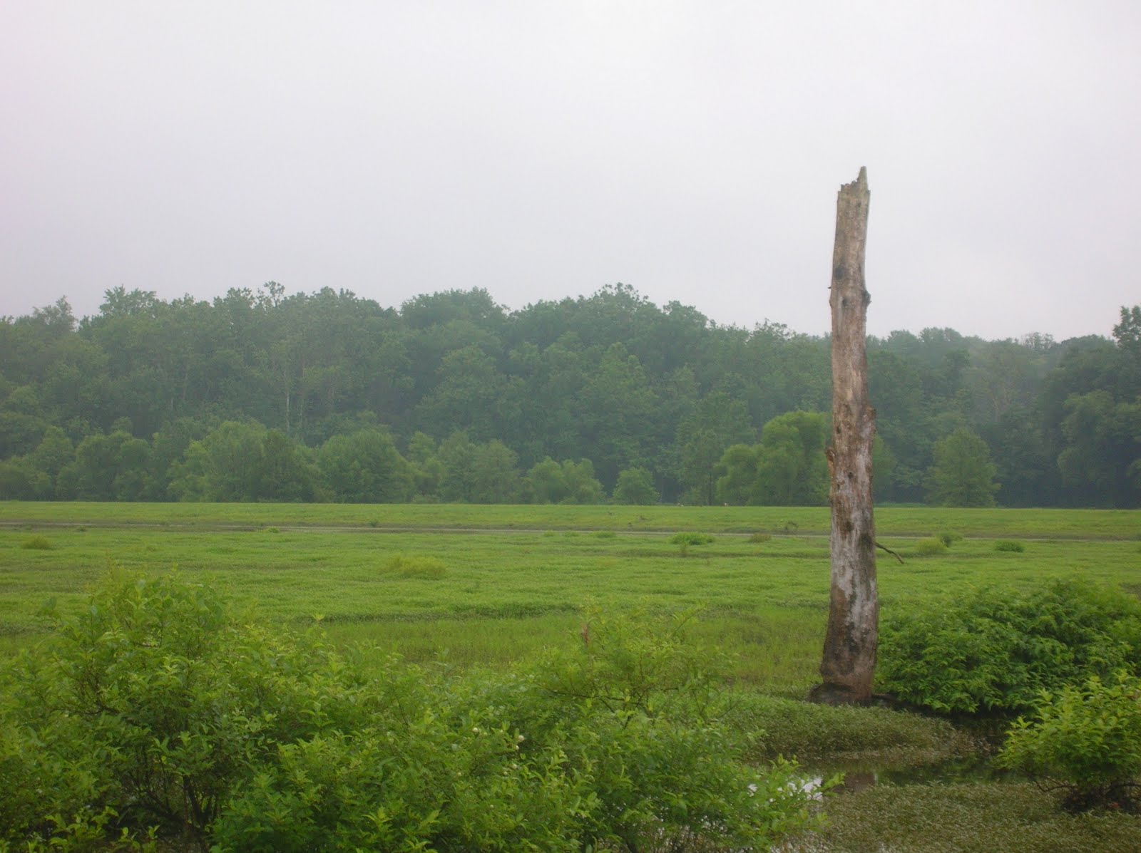
Odd dead skeleton of a tree at the top of the hill. Reminded me of Calvary.
Ruing the lack of gravel, at the bottom of a descent I encountered both an interestingly painted house hand the beginnings of gravel which shortly transformed. The early gravel portions were *very* heavy and I had to follow what looked like a water draining even with the 2.1" tires. Once I saw the house and turned the corner, to my surprise I was presented with virtually unimproved a dirt, rock. gravel roadway. Paydirt!!


After a long, steady, mushy, thrilling descent, I encountered something completely new. Clear Branch Rd. emptied out into the middle of Clear Branch Creek. I've crossed several creeks in my mixed-terrain ramblings, but I don't think I've every had to use the creek as a road. I thanks my stars that I had my 2.1"s here. It would have been tough going on a pair of 32c knobbies.


The road crossed back and forth across the creek several times before coming towards the end as you can see below, along with the retaining wall. I can only imagine this as a tough spot to travel through during a really rainy spell. The retaining wall belonged to a house that was only accessible by this road as best as I could tell, and it had "creek road" on both sides.


exit
After the marvelous stretch of Clear Branch Rd., I knew that I might find other mixed-terrain, but it couldn't be any better than that. My route took me along 501 again before turning upward via Matherly Rd., where I encountered a key feature of the middle portion of the route. While climbing I was passed by a descending Amish/Mennonite buggy (sucks to be that horse!). Along the ridge above Matherly Rd. I continued finding the significant influence of an established Amish/Mennonite community all living along the ridge. Earlier I figured that I was one of the few "cyclists" to take in these roads. To my surprise, I first passed a mill with ten or more bicycles parked outside and shortly thereafter I overtook an Amish/Mennonnite gentleman on a Dutch city bike battling the headwind uphill just as I was doing. So much for the "solo cyclist" cred!
What I saw first of this residence was the tents out front. Summer for the Amish kids too!


Mega deer stand? Water tower sans tank? Fire tower?


I didn't take any pics of actual Amish/Mennonite folks because I think it's poor form although I really wanted too. As I understand, the Amish don't maintain any contact while the Mennonites are "Amish light". I saw some different semblances of machinery and such, so I don't know what to categorize these folks as. My route dived down S. Fork Creek Rd., which again was marked as gravel, which is what I found. Good gravel and a good creek valley road.
Beautiful setting here of a house on a hill overlooking the valley below, and the higher hills in the distance. A pic doesn't quite capture it.


To my disappointment, after a short while the road turned to pavement, but the valley roll was still a nice one. One or two pics of the scene below can't capture what I saw. Having some of the hallmarks of a hand-hewn Amish barn, the homestead below was a miniature self sufficient farm. It had chickens, eggs, gardens, a vineyard, several barns in good repair and like the other pic, clothes out drying. I saw the farmer on his tractor with his long while beard and hat and wished I could stop and talk about his lifestyle. It looked enchanting, to be honest.


At this turn I decided to modify my route. I wasn't making great time and I needed to get back to Louisville for an engagement, so instead of turning left onto Sloans Fork Rd.  I continued straight, cutting off a bit of mileage. The "H&H Bicycles" sign amused me, but that bike shop might see more business than the ones in the 'Ville. I have a feeling it existed to service the many Amish 2-wheelers in the area. The further portions of S.Fork Creek Rd. had many signs of the vibrant Amish community here, with a large produce business, another mill, numerous fields planted with tomatoes and at least 4 more buggies. (Again, no pics).

The juxtaposition of the Amish households and the local ones was striking sometimes. The Amish homesteads all exhibited evidence of industry: gardens, laundry, livestock, several non-motorized vehicles, numerous outbuildings, etc. They were all well-maintained and purposeful. In contrast, many of the locals' homes had trash and old jalopies littering the yard. There were mean dogs and a general pall of filth. Industry vs. Sloth. Antiquated vs. Modern. Striking in many ways.


I found less gravel than expected, but more mixed-terrain than was apparent. Many of the roads were patched with gravel instead of re-pavement, so the 2.1" came in handy.

Only pic of an Amish buggy, disappearing behind their greenhouse.


I fell off of the ride on Rayborn Hill Rd. and began my return leg along 501. I was a little tired at this point and ready to face the 8m of boring road riding. In this stretch my hands began to tire of the 29er setup. I very much like the Jones Loop Bar, but the stem is a bit low and my position a bit pitched over to be very comfortable. In some instances my hands were getting downright numb. I'm disappointed b/c I think the C'dale has many nice qualities, but gravel rides at distance are not going to happen, not unlike the Blueridge for other reasons. Back to the (LHT) drawing board.

Shed completely covered with old license plates. Closer inspection showed that they were local but of all types like cars, trailers, tractors, boats and such. Note to the right that the brighter plates are the only more recent ones.

C'dale 29er. If I could get the hands more comfy it would be quite the gravel rig. But alas.

501
I finished back up at camp with a total of 33 miles, 5 fewer than planned. I encountered less gravel than expected as well, but Clear Branch made up for it. A successful day in my SCS.

Sunday, June 19, 2011

SCS Sunday

We couldn't use our Father's Day to go to Holiday World due to storms so I took a ride with an improving- or plateaued- Dave. Coffee and a beer. Success.

Muscatutuck/Jackson-Washington MT

Michael and I met up for some adventure riding after several attempts. He is finally free of school for a while and, well, for me it's SCS so any excuse to hit the bike is bonus!

We in started in Muscutatuck NWR, the place we visited in March. Instead of looping around that area, though, we came up with a route that headed west towards Jackson-Washington IN Forest, an area the Apertome's had visited previously.


Texture

There's a heron between those trees. Promise.
Our westerly route involved a fair amount of headwind, and although the pics show otherwise, some rollers too to help break up the route. I had to persuade Michael to slow down a couple times. He was hammering along and I wasn't on my sharpest form.


Love this church setting. Couldn't find the name on googlemaps.

Homemade Amish sign

We had a stop-over in Brownstown, where we availed ourselves of the Mickey D's for water and a restroom. I had an odd interaction wherein I saw a lady looking at me (woo woo!). Later a man came outside and he stated that he had ridden up from Louisville. Then I stated that he looked familiar, yada yada. The woman said something about my "Bono glasses". Long short, they were/are a family whose son played soccer two years ago with my son, *and* they had moved to Utah but were in the 'Ville visiting. What are the odds of that all coming together? The skies grew ominous in Brownstown.

After our departure from Brownstown we had our "comes in threes" moment. I felt my rear tire going soft and stopped to change it. As I was changing it, the ominious skies dumped a brief shower on us. And then .5m up the road we found our road "closed" with a sign blocking it. But undeterred, we jumped the gate and started climbing to see what we would find. The climb up was marvelous!

The next several miles would prove the most satisfying of our day. The northern swatch of Jackson-Washington SF provide ambiance, climbing, vistas, rain, flow, green, and all-round excellence.
Bad pic, but left in for narrative purposes.


Machines


Departing J-W SF I was glad we had chosen Michael's route over my flatter one. Interestingly, the descent out of the forest was the first time I had ever walked a climb *downhill*; that was some steep stuff!

After the forest the route flattened out and proceeded straight as an arrow down E.CR400S. Somewhere in this area I began to feel sort of crummy. My stomach was swishy and I had some concerns about the heart rhythm. I informed Michael that I needed to slow a bit and ride it out. To our east and SE we watched a thunderstorm that had missed us to the north and we went, straight.


Bike+Camera nerd


Photo can't do this justice. The browns of the wheat, the greys of the clouds and four shades of green from the fields and trees.

Along CR400 at one point the road flattened out even more and "descended" into this bizarre flood plain where the asphalt was heaved up, we assumed, from flood damage. Map study showed that this was part of the flood plain of the North Vernon Fork of the Muscatatuck R., the same one that created the NWR. The extensive Spring rains made the fields in this area almost useless. Of note, as well, were two different gravel roads going south, CR800E and 900E. Under almost any other circumstances I would have enjoyed an exploration, but I still didn't feel particularly good.


At some point our directions had us diving down a brief descent where we found more gravel. The road name could have been S.CR1125E, E.CR25S or S.CR1075E. Who's to know? But the gravel, while a bit rough here, seemed to wake me up a bit. We were passed by a nasty beat-up car, which we watched into the distance while it made mega-splashes in the pot holes. This area was part of the same flood plain again and several of the roads were gravel here b/c they served virtually no purpose. It was rustic, but for whatev reason, it was what I personally needed.


From there we turned into the wind, making our return a bit more challenging. We faced one stretch where we were seemingly passed by 10 red trucks. I named the same area 'Hillybilly Hollywood' for some nice but badly-designed batch of brick homes with excessive architectural detail. They were something to study in lieu of thinking about the wind. We turn north for our last homestretch, all the while with me personally finding my legs at mile 35 or so. Strange.

We turned into Muscutatuck somewhat dramatically, with me catching a toe-overlap and ripping my front fender out of the rivets. My remainder would be ridden with a front mudguard constantly bouncing on the front tire.
Muscutatuck NWF grassy road

Michael unfortunately out of focus

For me it wasn't the easiest of days, but the section in J-W SF alone was worth the price, in addition to 56 greedy SCS miles. As always, Michael was a perfect ride companion and I appreciate his efforts to drive down and take it all in. One lesson from the day is that the Blueridge will *not* be my gravel grinder of choice in the future. It's a great bike which I'm enjoying, but it's a bit too dainty for the big grind. It'll be back to the LHT for me, for the time being. A successful day and I look forward to Apertome's more "pro" pics.

Alabama Sky Day 3 Vistas

We began Day 3 with a basic breakfast at the restaurant, again better than camp cooking a salt bomb,and bundled up for a long descent in th...